

You are viewing an archived web page that is no longer maintained. View current CISN web pages
Details | Ground motions | Maps | Waveforms | Related links
| Information from the CISN | |
| Date & Time (Local): | 2005/09/01 06:27:19 PM (PDT) |
| Date & Time (UTC): | 2005/09/02 01:27:19 (UTC) |
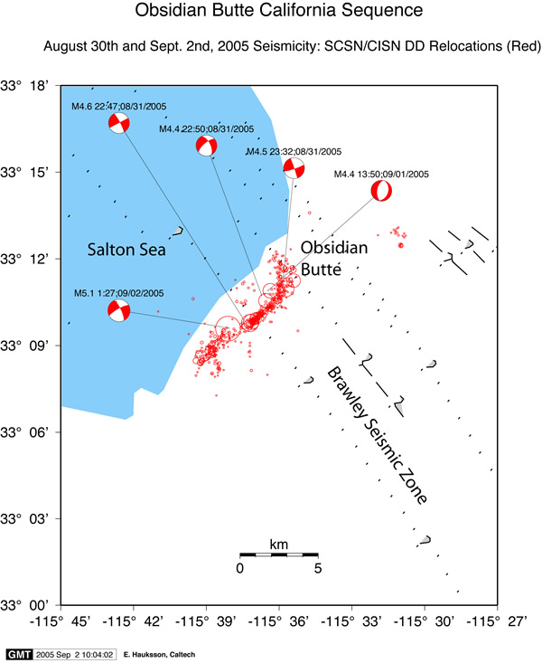
| Location: | 1 mile S of Obsidian Butte, CA 33.160 115.637W |
| Depth (km): | 9.7 |
| Magnitude: | 5.1 Mw |
 Sept 2 update:
Renewed seismic activity in the
Brawley Seismic Zone began
late on 28 August 2005 but reached a sustained higher level of activity,
announced by back-to-back M4.6 and M4.5 events at 3:47 and 3:50 p.m. (local
time; PDT [GMT-8]) on 31 August 2005. The swarm then intensified, with a M 5.1
event on 1 Sept. at 6:27 p.m. PDT. As of this writing, seismic swarm activity
persists at a slightly diminished level, yet activity can reasonably be
expected to continue (see STEP
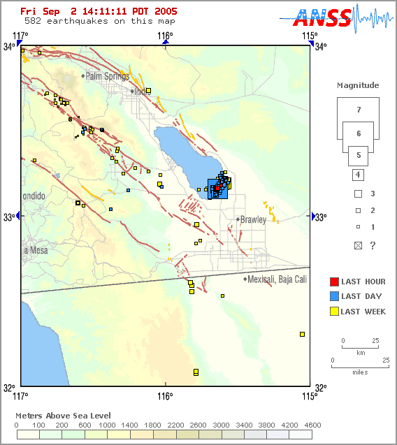
map). We now have recorded a total of 8 events of M 4.0+, 29 additional events
of magnitude between 3.0 and 4.0, and 175 events between magnitude 2.0 and 3.0.
In all, 554 events of M 1.0+ have occurred in the swarm so far.
Sept 2 update:
Renewed seismic activity in the
Brawley Seismic Zone began
late on 28 August 2005 but reached a sustained higher level of activity,
announced by back-to-back M4.6 and M4.5 events at 3:47 and 3:50 p.m. (local
time; PDT [GMT-8]) on 31 August 2005. The swarm then intensified, with a M 5.1
event on 1 Sept. at 6:27 p.m. PDT. As of this writing, seismic swarm activity
persists at a slightly diminished level, yet activity can reasonably be
expected to continue (see STEP
map). We now have recorded a total of 8 events of M 4.0+, 29 additional events
of magnitude between 3.0 and 4.0, and 175 events between magnitude 2.0 and 3.0.
In all, 554 events of M 1.0+ have occurred in the swarm so far.
The activity is reminiscent of similar swarms that occurred in the Brawley Seismic Zone throughout the 1970Õs and 1980Õs, during which time the zone was among the most active areas in all of California. The Brawley Seismic Zone is a north-striking zone of northwest and northeast-striking faults that extends from the southern end of the San Andreas fault to the northern end of the Imperial fault. Across this zone, tectonic spreading that is oriented NW-SE occurs within the transition from the Gulf of California mid-ocean ridge to the San Andreas transform fault. Historically, activity includes both northeast-oriented cross-faults that typically involve left-lateral faulting, such as is currently occurring, and activity on northerly to northwesterly-oriented strands of the zone. The set of nearly orthogonal strike-slip faults accommodates the overall tectonic NW-SE opening, partly through the rotation of crustal blocks.
The largest earthquakes to have occurred on the cross-faults were the magnitude 6.2 Elmore Ranch event in 1987, which is considered to have triggered the magnitude 6.6 Superstition Hills event less than 12 hours later, and the magnitude 5.7 Westmorland event in 1981. Although Brawley Seismic Zone activity is clearly proximal to the southern San Andreas fault, the San Jacinto fault zone, and the Imperial fault, the current activity is remaining more than 10 km distant from any of these major faults. Obsidian Butte is part of the Salton Buttes Lava Domes, which are primarily formed by their namesake volcanic rock type, with nearby geothermal activity and energy production.
The pattern of Brawley swarms of the 1970Õs was a large number of very small earthquakes (sometimes exceeding 10,000 events) with up to a dozen moderate events of magnitude 4 or so, but no clear mainshock larger than the other events. The 1970Õs swarms would be highly active for a few days and then taper off over the next week or two.
In 1999 and 2001, two other smaller swarms occurred on northeast-striking faults in the Salton Sea. Compared to those two sequences, this weekÕs swarm has significantly more events, but also is located significantly farther away from the San Andreas fault.
The CISN Southern California Management Center produces ShakeMaps for events of M3.5 and higher. ShakeMaps are based on the observed ground motions from seismic instruments combined with predicted motions in areas without sensors. In this swarm ShakeMaps have been produced for several events - only the largest events are listed here.
Many earthquakes in this swarm have been felt. People with Internet access can report their observations of shaking and damage through the Did You Feel It? Web site. In the links below, you can see the maps illustrating the reported intensities for several events in this sequence. Unlike the ShakeMaps - which are based on data from seismic instruments - these maps are based on human observations. You can contribute to these data by filling out the form for each event.
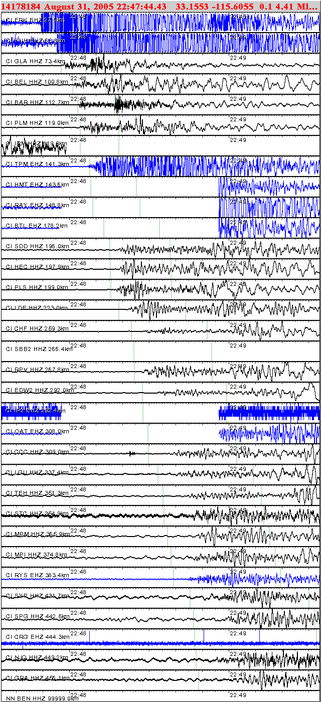
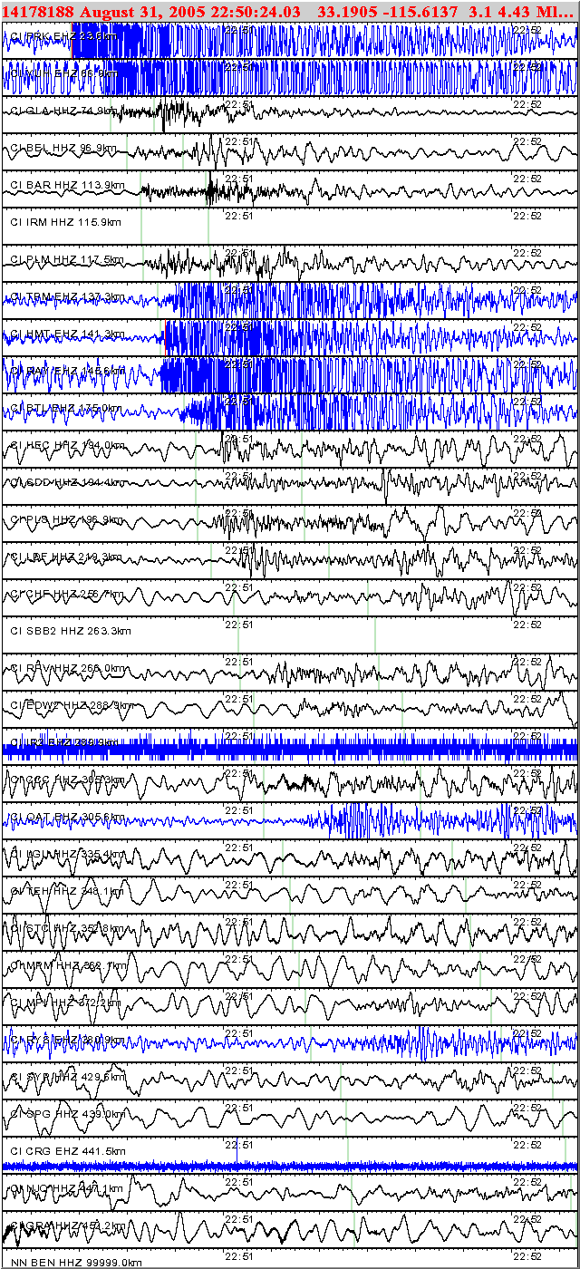
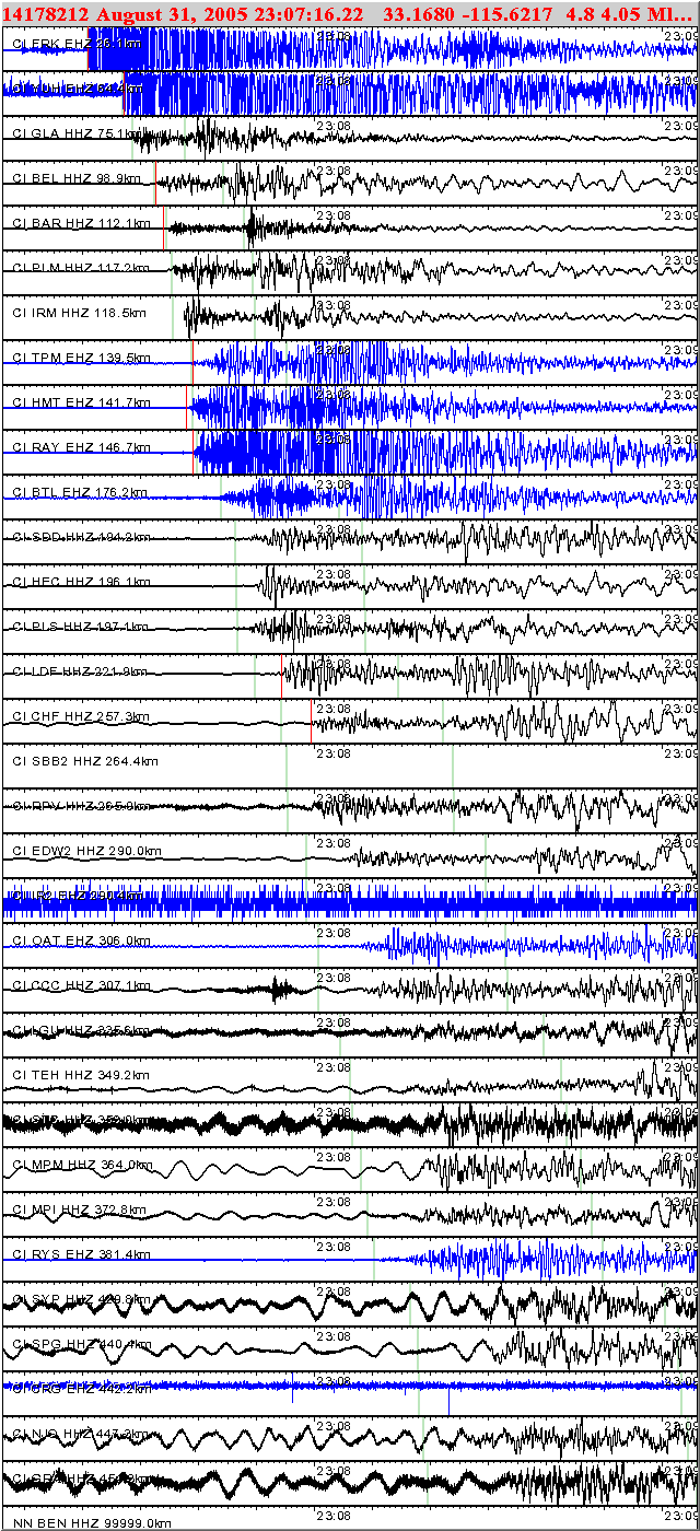
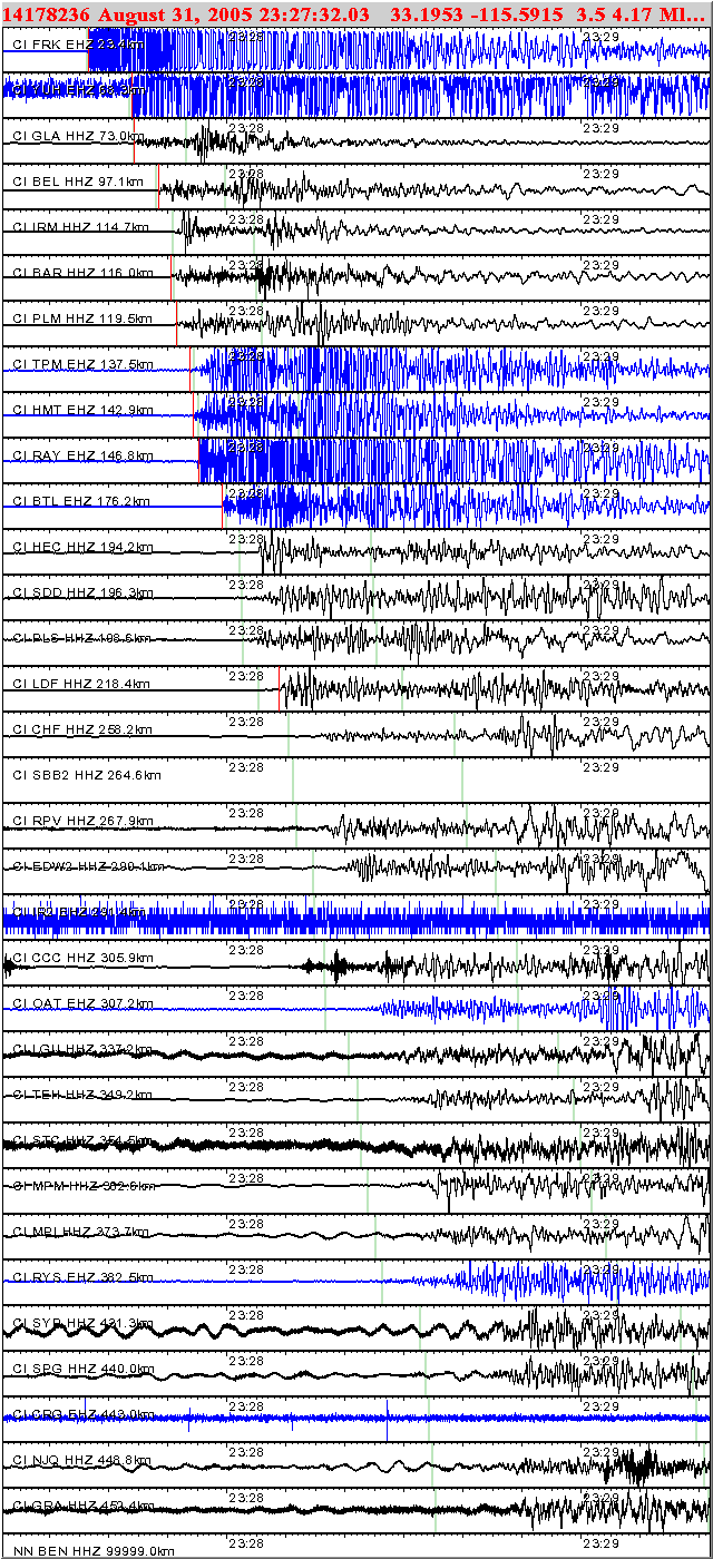
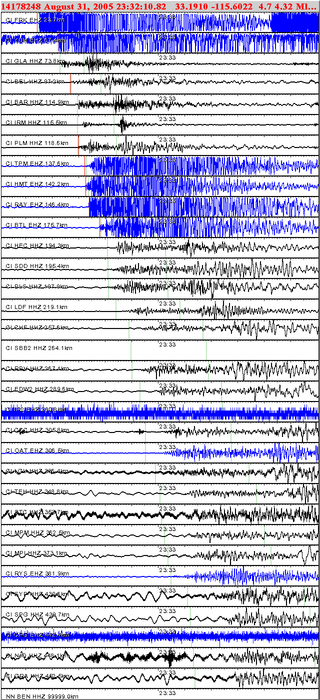
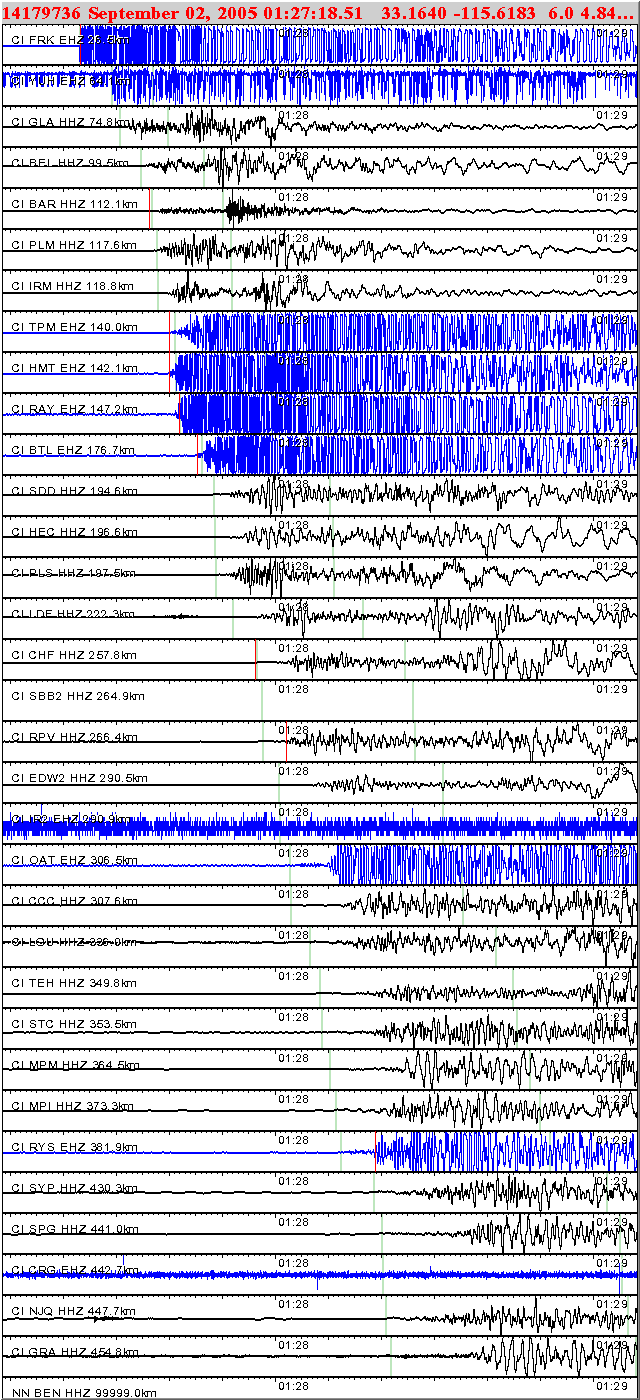
Below are links to waveforms for the events of M4 and higher