

You are viewing an archived web page that is no longer maintained. View current CISN web pages
Details | Ground motions | Maps | Waveforms | Related links
|
|
||||||||||||
|
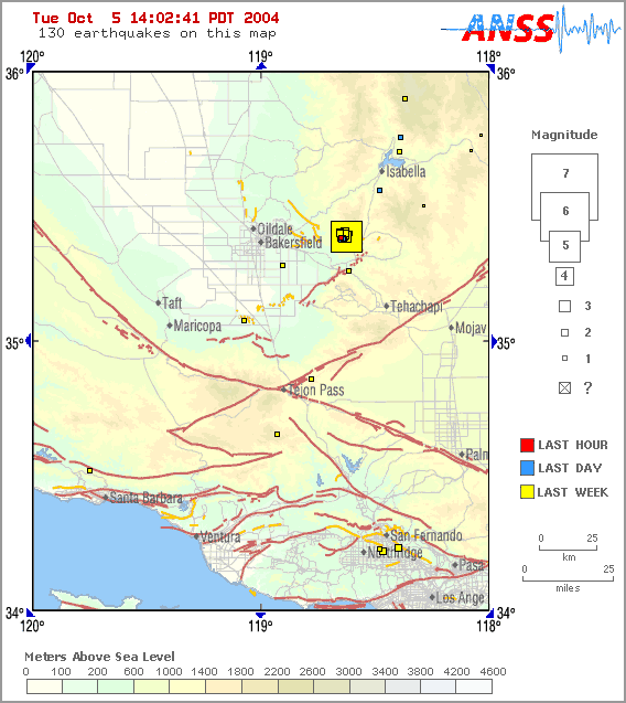
Map showing the location of the M5.0 as of 14:02 on 10/5/2004 |
|||||||||||||
A Mw5.0 earthquake occurred in southern California on Wednesday, Sept. 29 at 3:54 p.m. located 17 miles northeast of Arvin in the southern Sierra Nevada. Because this occurred just over a day and less than 200 km southeast of the Mw6.0 Parkfield earthquake, there may be a correlation between the events. We have in the past, such as July 1986 and June-July 1992 seen moderate to large earthquakes over wide areas of California.
The proximity of these two earthquakes in time and space, while not completely understood, is consistent with our growing understanding that earthquakes can sometimes be triggered by other earthquakes. Because investigations of triggered earthquakes remain in their infancy, we cannot quantify precise probabilities of further triggered events beyond saying "very low." The precise nature of the relationship (if any) between the two earthquakes is also unclear, and may be illuminated by future in-depth analysis of the data. As with any M5.0 earthquake, however, the Mw5.0 mainshock has begun generating its own local aftershocks.
The Mw5.0 had a strike-slip focal mechanism, with left-lateral motion on a nodal plane striking N65W. This is opposite motion to what is normally observed for San Andreas type earthquakes. The depth of the event is about 6.5 km.
These earthquakes accommodate crustal thinning within the southern Sierra Nevada. Extension occurs in both north-south and east-west direction, causing gradual oblate flattening of the range. The extensional deformation is associated with areas of high potential energy, and may be seismic expression of buoyancy-driven thinning of the Sierran lithosphere.
This earthquake today occurred about 8 km to the north of a M4.3 earthquake that occurred 25 January 2003. The 2003 M4.3 event was part of a large swarm of earthquakes that consisted of more than 1000 smaller events.
The CISN Southern California Management Center produces ShakeMaps for events of M3.5 and higher. ShakeMaps are based on the observed ground motions from seismic instruments combined with predicted motions in areas without sensors. In this sequence ShakeMaps have been produced for several events.
Many earthquakes in this swarm have been widely felt. People with Internet access can report their observations of shaking and damage through the Did You Feel It? Web site. In the links below, you can see the maps illustrating the reported intensities for several events in this sequence. Unlike the ShakeMaps - which are based on data from seismic instruments - these maps are based on human observations. You can contribute to these data by filling out the form for each event.
Below are links to waveforms for the 5.0 ML event.