
You are viewing an archived web page that is no longer maintained. View current CISN web pages
|
|
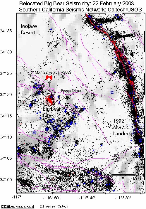
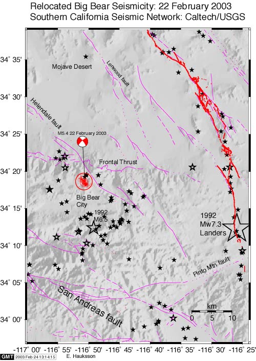
| Background seismicity 1981 to 2003 shown as black dots. Earthquakes of magnitude 4.0 or larger are shown as blue stars. The most recent activity near Big Bear City shown as red circles with focal mechanism, shown as the beach ball. | Earthquakes (1981 to present) of magnitude 4.0 or larger are shown as black stars. The 22 Feb. 2003 activity near Big Bear City shown as red circles with focal mechanism, shown as the beach ball. The late Quaternary faults are shown in purple while the 1992 Landers rupture is shown in red. |