
Magnitude 4 earthquakes near Ukiah, CA
| Information from UCB & USGS Menlo Park |
| Date & Time (Local): |
2001/12/07
06:29:09 (PDT) |
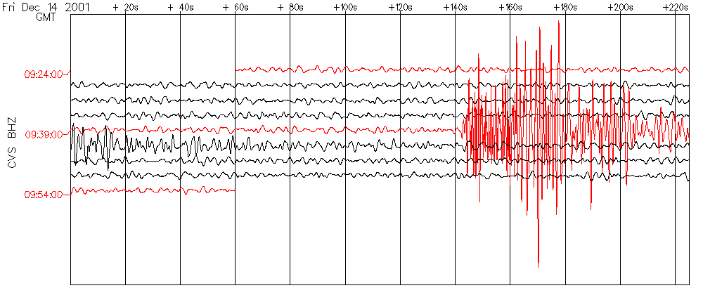
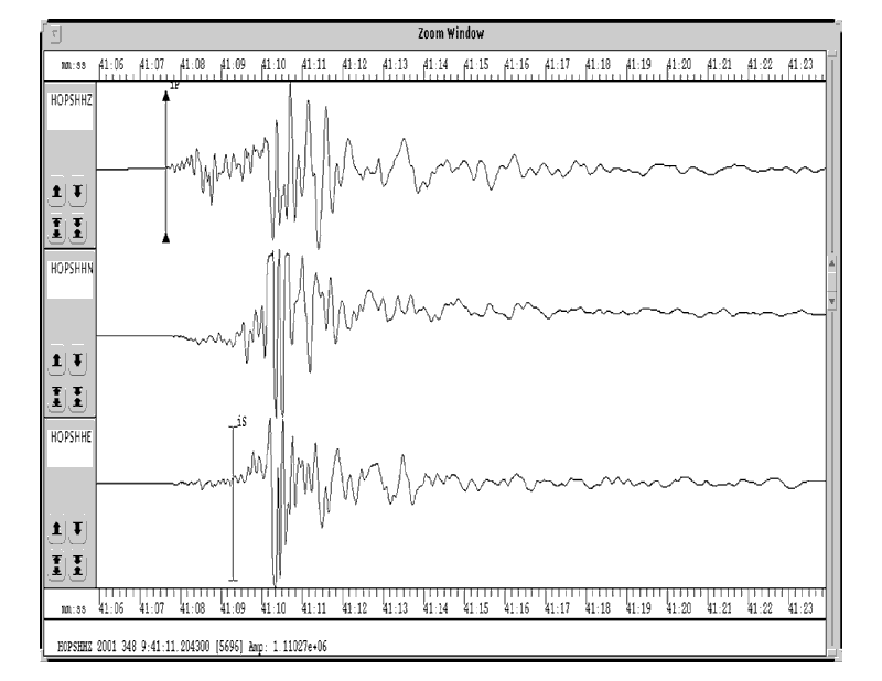
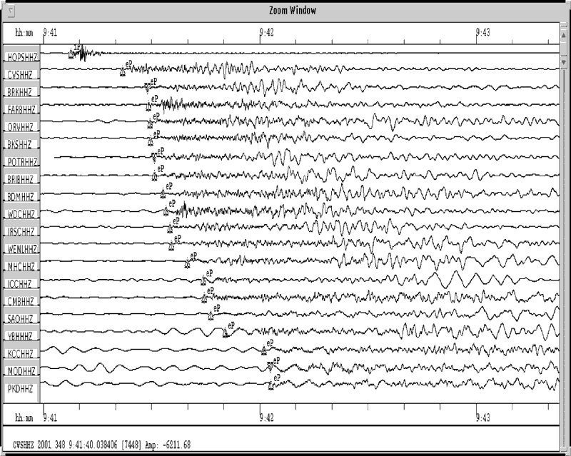
2001/12/14
01:41:05 (PDT) |
| Date & Time (UTC): |
2001/12/07
14:29:09 (UTC) |
2001/12/14
09:41:05 (UTC) |
| Location: |
14 km (9 miles) SSE of Ukiah, CA
39.042, -123.115 |
14 km (9 miles) SSE of Ukiah, CA
39.045, -123.120 |
| Depth (km): |
6.9 |
6.9 |
| ML: |
4.1 |
4.1 |
| MW (preferred): |
4.3 |
4.4 |
| Fault Zone: |
Maacama |
The Ukiah area recently experienced two M4.0+ events. The first, which occurred on December 7,
had a local magnitude (ML) of 4.1 and moment magnitude (Mw) of 4.3.
The December 14 event was located just
northwest of the December 7th earthquake, both of which occurred along the Maacama Fault
Zone. This fault zone is thought to slip at a rate of about 9mm/year, similar to the
slip rate along the Rodgers Creek and Hayward Fault Zones that continue to the south.
More information about the earthquake potential of the Maacama Fault and other faults
in this region can be found in a 1996 USGS report on
Northern California Earthquake Potential,
particularly in the section on North Coast faults.
Details
Maps
Seismograms
Ground shaking information
- Northern California Shake Map - see the observed ground motions!
- Community Internet Intensity Maps - see what other people felt and report your observations!
Return to the Events of Interest
Return to the Berkeley Seismological Laboratory
Berkeley Seismological Laboratory, 202 McCone Hall, UC Berkeley, Berkeley CA 94720-4760
Questions or comments? Send e-mail: www@seismo.berkeley.edu
© 2001, The Regents of the University of California.